Module for Interactive visualiZation from Astronomical Repositories
MIZAR is a web client, developed by CNES with the support of IAS for scientific requirements and CDS as data provider. The main asset of Mizar is to provide a high performance 3D application for discovering and visualizing geospatial data on both sky and planets.
Data Visualization
MIZAR can be deployed alone or with its own server. According to the deployment, the data visualization capabilities are differents.
What can be visualized with MIZAR, deployed as standalone ?
- A Simple FITS file
- A geoJson format (point or polygons)
- a MOC format as JSON
- a HIPS format
What can be visualized with MIZAR, deployed along its server ?
- A Simple FITS file
- A geoJson format (point or polygons)
- a MOC format as JSON
- a HIPS format (with cache)
- data from SIAP server (with cache and large data volume)
- data from CSP server (with cache and large data volume)
- data from anywhere with the appropriate plugin
Web processing
MIZAR has some processing task on displayed information
What can be processed with MIZAR, deployed as standalone ?
- The cuts and the color scale on a FITS file, which is displayed
What can be visualized with MIZAR, deployed along its server ?
- The cuts and the color scale on a FITS file, which is displayed
- Exporting information as VOTable
- Cut out Service
- Zscale Service
- SAMP
Screenshots and examples
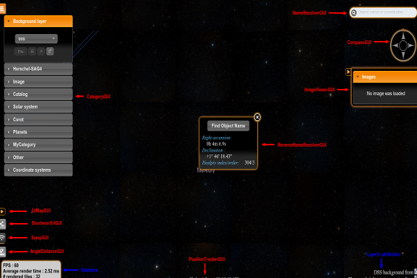
Ergonomic GUI
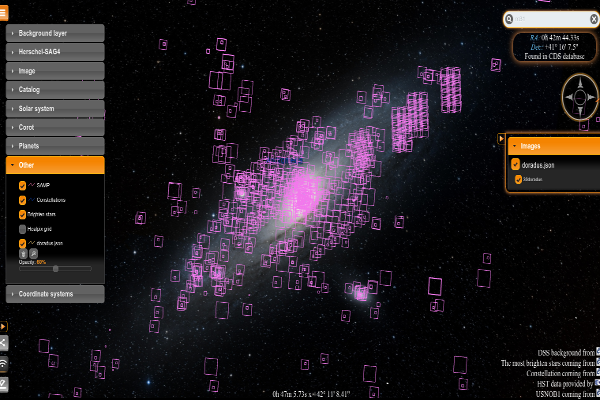
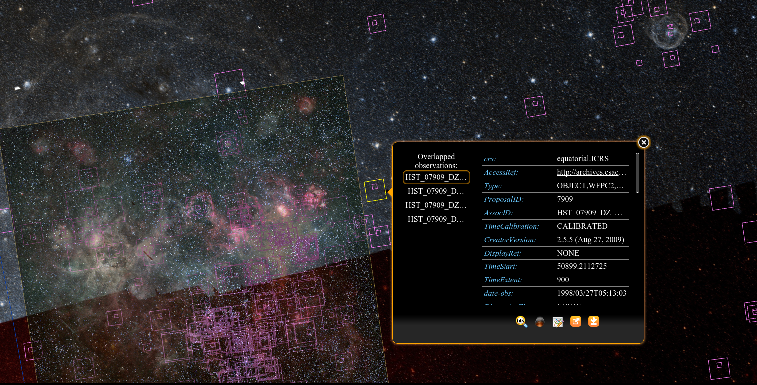
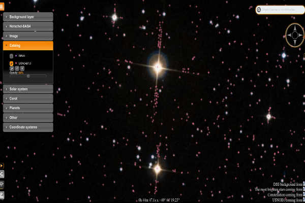
Raster and Overlay representation
Opacity handling
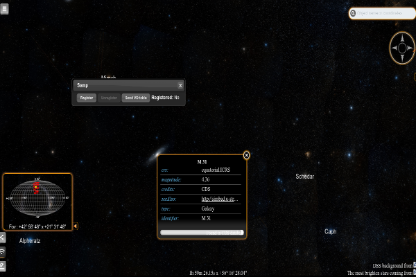
Navigation and communication
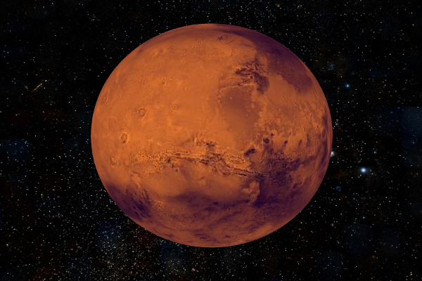
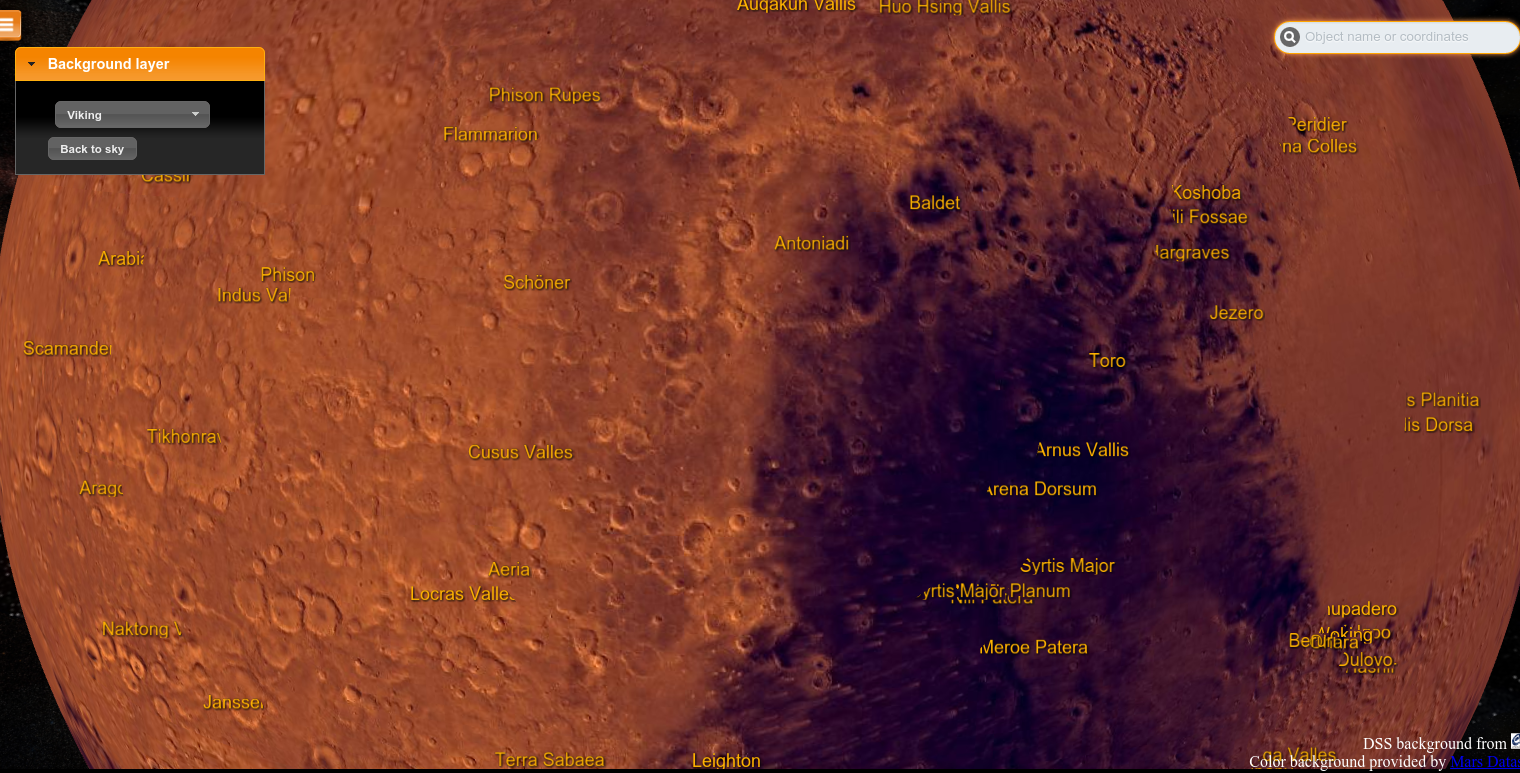
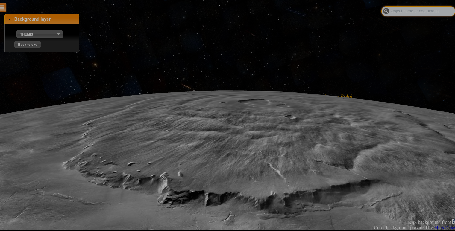
Raster and overlays on Planets
JS API to embed MIZAR in an external web page
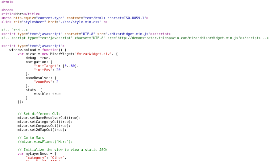
MIZAR-lite
You can also embed MIZAR in your own web page which is called Mizar-lite. Then, you can pilot it by handling its JavaScript API. As below, an example of a embedded MIZAR
| POIs |
|---|
| Mizar |
| Atlas |
| m31 |
| m42 |
| Polaris |
| ID | Ra | Dec | Download |
|---|